Thursday, February 24, 2011

Update on Tonight and Tomorrow's Severe Weather Threat

Things are really cooking up in the Southern Mississippi Valley and continuing to push eastward.  First let me go ahead and show you how things are set up right now. 
You can see a thin red line of where the heaviest precipitation is and the strongest storms are stretching from northern LA to western KY.  This line is what is causing all the watches and warnings to pop up right now and isn't anything to take lightly.  Here are the current watches and warnings (these change constantly so keep in mind this is for 7:36 PM CST) 
Tornado WarningTornado Warning
Tornado WatchTornado Watch
Severe Thunderstorm WarningSevere Thunderstorm Warning
Severe Thunderstorm WatchSevere Thunderstorm Watch
Winter Weather StatementWinter Weather Statement
High Wind AdvisoryHigh Wind Advisory
Flood WarningFlood Warning
Flood Watch / Flood StatementFlood Watch / Flood Statement
Fire Weather AdvisoryFire Weather Advisory

Here are the storm reports as of 7:42 PM CST  Today's severe weather reports
Looking at these you can see a few red dots meaning tornado reports.  These were reported in Arkansas and Missouri.  The green dots represent hail reports and there are only a few of them and thats because there isn't much low-level below freezing temperatures and the updrafts are not strong enough for most storms to really produce much hail.  The rest is all blue dots meaning very strong wind reports.  If you compare this image with the radar you can see that most of the tornadic weather is in western TN and KY.  That long squall line that was lined up with the Mississippi River is predominantly creating very windy conditions where wind reports will be high likely ahead and in the path of the squall line.  That means majority of MS will likely see wind reports for this event and not hail reports and a very possibility of a tornado being reported.  Western TN has already seen several tornado warnings and  they haven't been varified yet, but that part of TN will likely see a few tornado touch downs.

That right there is where the southern states stand at this moment.  Continuous updates will be made and if you want to follow me I do have a Twitter account that you can follow all that is going on.  All images from above are from NOAA and Wunderground.

Wednesday, February 23, 2011

February 24th & 25th 2011 Severe Weather Threat

Something different this time to talk about for the United States than what I have talked about.  We are getting closer to spring and that means severe weather is knocking at the backdoor.  As a matter of fact, that's exactly what is happening right now for the Southern Mississippi Valley.  There is a potential for some severe weather to be seen in Louisiana, Mississippi, Arkansas, eastern Texas, Tennessee, and Alabama.  Here is the current convective outlook from Thursday 1200Z (6:00 AM) to Friday 1200Z (6:00 AM) from the Storm Prediction Center.  SPC Day 2 1730Z Outlook Categorical
What this is showing is the risks of severe weather.  The brown line shows the general area where severe weather is possible.  The important lines are the green "slight" risk line and, more important, the red "moderate" line.  The slight risk line is saying that all the states and parts of states within that line are in a slight risk of severe thunderstorms.  The moderate risk line is saying that every portion of the states inside that line are in a moderate risk of seeing severe thunderstorms.  This may not seem like much, but allow me to put this in perspective for you.  The Storm Prediction Center will issue slight risk on the day 2 convective outlook, but it isn't common for the Storm Prediction Center to issue a moderate risk on a day 2 convective outlook which indicates that something in the atmosphere is going to mix just right to create severe weather.  If you are wondering what the percentages or probabilities of severe weather for this region is here is a map to show you.  SPC Day 2 1730Z Prob Outlook
The pink 45% line is telling us that the area within that line has a 45% or higher chance of seeing some severe weather.  The same goes for 30%, 15% and 5%.  There is another signifcant color surrounding the 45% line and that's a blue line that's hatched inside.  What this is telling us is that the hatchet area has a 10% or greater chance of significant severe weather which means that cities such as Tunica, MS; Memphis, TN; Texarkana, TX & AR; and Little Rock, AR.  What is the difference you ask?  It is basically the difference between experiencing a severe thunderstorm to just produce lightning and heavy rain to a thunderstorm that could produce strong winds, hail, and the possibility of a tornado.  If you would like to read the discussion on why this could happen and the details to it then visit http://www.spc.noaa.gov/products/outlook/day2otlk.html.

Several NWS offices are showing various graphics on this severe weather threat.  I will show you images from NWS offices from 4 different NWS offices.  Here is what the NWS in Little Rock, AR is showing on the severe weather for Thursday.  Thursday Pattern - Click for more information.Simulated Radar

Now an image from the NWS in Shreveport, LA.  Severe Weather - Click for more information.

Images from the NWS in Jackson, MS.  Severe Thursday - Click for more information.Thu Svr Timing - Click for more information.

Finally an image from the NWS in Memphis, TN. 

The point of all these is to see the perspective from each NWS office that is going to be experiencing the severe weather for tomorrow.  The highest threat stays around the Memphis area and west TN, northern MS, and most of Arkansa.  Alabama was mentioned at the beginning to get the severe weather and they will, but they will see the highest probability of severe weather on Friday.

I will keep everyone updated on the severe weather threat tomorrow as it progresses on things start to unfold.  I will also post more images tomorrow on an updated blog on this event pertaining to Alabama and other areas that will be effected with this event on Friday.  If you would like to see and read more details of this event from the previous NWS offices here are the thinks to each one for you to look at.  For Little Rock, AR: http://www.srh.noaa.gov/lzk/, for Shreveport, LA: http://www.srh.noaa.gov/shv/, for Jackson, MS: http://www.srh.noaa.gov/jan/, and Memphis, TN: http://www.srh.noaa.gov/meg/.

Wednesday, February 16, 2011

Spring in Winter

What transition from last week to this week.  Lets have a flash back on last week.  Here is what the setup was in the upper levels of the atmosphere. 

This is a 300mb map for the middle of last week when all of the cold weather was coming through.  The purple colors is what known as a jet streak which is an area of strong winds compared to what is surrounding it.  This map shows where the jet stream is which separates warm air from the south and cold air from the north and is caused by this contrast in temperatures.  Now what this is showing is the path that the cold front travelled that gave the southern states all of the snow.  The winds are significant because they are showing how fast the weather pushed on through which holds strong because the snow lasted less than 12 hours before it completely left Mississippi and rapidly moved across the other southeastern states.  The pink lines are areas of upper level divergence meaning areas that air is being lifted from lower levels of the atmosphere creating some instability which is a key factor for areas of precipitation.  The main point of the map is to show how deep the trough is that was pushing all the cold, arctic air into the Southeast region.

Now lets look at the pattern in the upper levels for today at 00z on Thursday (this is at 6PM CST). 

Can you see the difference?  If not, then allow me to tell you and show you what makes this week so much different, and more spring-like, than last week.  First, I would like to point out the ridge that is visible in the central part of the U.S.  This may not seem like anything special, but what it means is that warmer air is pushing further north and giving the southern states warmer air along with a more stable atmosphere.  The last thing I would like to point out is where the jet stream is.  Much further north than last week which keeps us away from the paths of low pressure systems.

So now you know the reason why this week is the way it is, last week was the way it was, and why it all happened.  For all of you spring lover's, expect the current pattern to persist because these upper level troughs and ridges last much longer than the ones closer to the surface.  Since the ridge is west of the southeast states, this day to day pattern of warm, spring-like temperatures in the upper 60's and lower 70's and some places much warmer will continue to occur until this weekend.  A trough will reach the Mid-Atlantic Region and could spread some showers in for the Southeast Region and with the warm temperatures the possibility of a thunderstorm here and there is not out of the question.  A short ridge will pus the trough out of the way leaving the southeastern states dry for Tuesday and Wednesday.  A deep, slow moving trough will be creeping towards the southern states in the middle of next week giving way for some higher chances of precipitation and cooler temperatures.

Thursday, February 10, 2011

Snow Curiosity: What Does It Look Like?

Snow is a beautiful site to see.  When you see white, frozen liquid falling from the sky covering everything you just can't help to get a smile on your face unless you get a lot of this and you are tired of it.  The South just had good snow event where some locations, like Starkville, MS, measured up to 6" of snow!!  This is amazing for The South, but have you wondered what it looks like?  Looking at a leaf, park bench, car, or anything else and see a bunch of snow and its unique shapes.  There are a lot of different classifying charts of the different types of snowflakes.  In general, there are about 16 different types of snowflakes.  Here is a table to show the various types of shapes of snowflakes. 

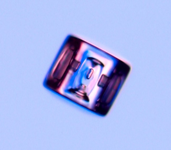
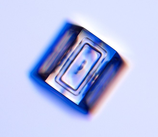
Now to break down this table into categories and images.  The first category that will be mentioned is just simple prisms.  These are hexagonal prisms that are the most basic of all of the snowflake types and are some of the smallest.  They can be so small that they cannot be seen with the naked eye.  Here are some images to give you an idea of what they look like. 


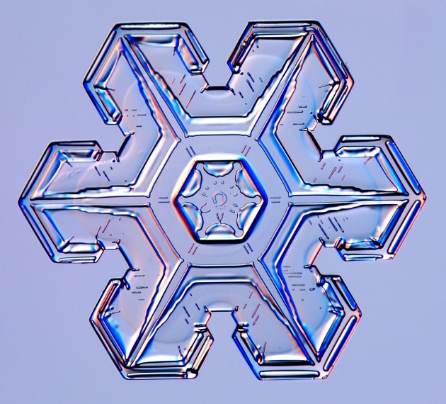
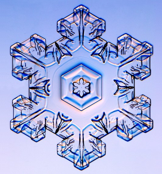
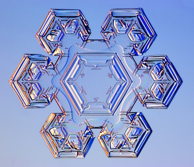
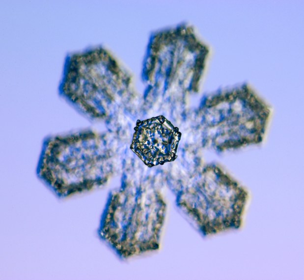
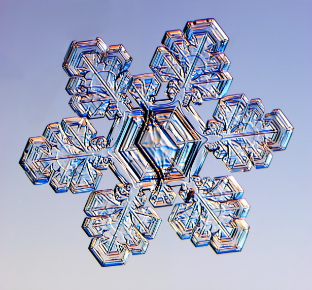
Now the next type of snowflakes are the stellar plates.  These are very common to see, but are very unique because they have an elaborate and decorative markings on the face of them that makes them look different from all others and from each other.  Like other plate-like snowflakes, these typically develop when temperatures are around 28°F and/or 5°F.  Here are some images of stellar plates. 


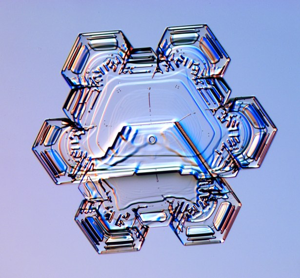
The other type of plate-like snowflakes are sectored plates.  These are similar to the previous plate-like snowflakes, but have more distinguishable edges to them that are more prominent than the others.  Here are some pictures of them. 


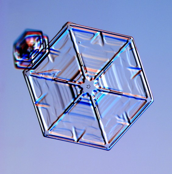
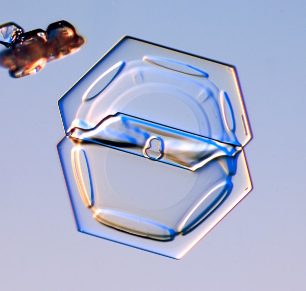
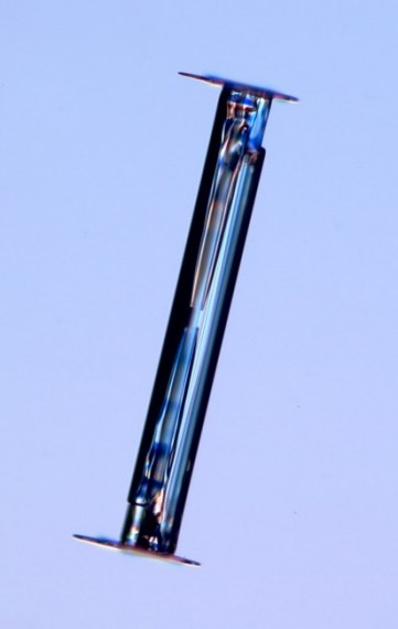
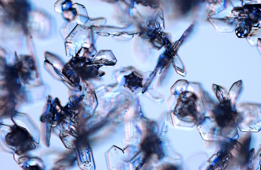
Another type of these kind of snowflakes are double plates.  These are very unique snowflake because they are like two plate-like snowflakes connected together.  They are very common as well and can be mistaken as the other plate-like snowflakes.  Here is what double plates look like.  The last image is what one looks like on its side.


The last of the plate-like snowflakes I will mention is a combination of plates and stars called split plates and stars.  These are a type of double plate snowflakes, but differe because one of the plates grows bigger than the other.  Just to give you an idea, here is what the look like. 


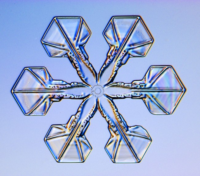
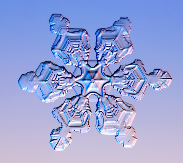
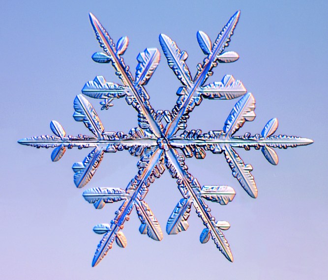
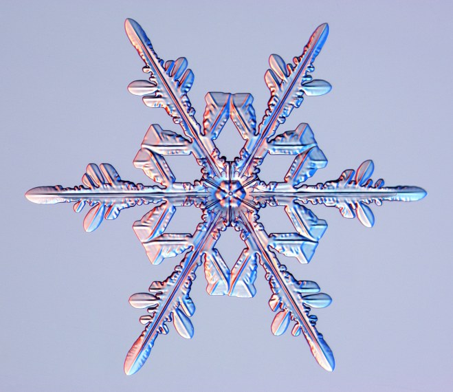
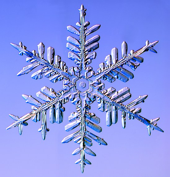
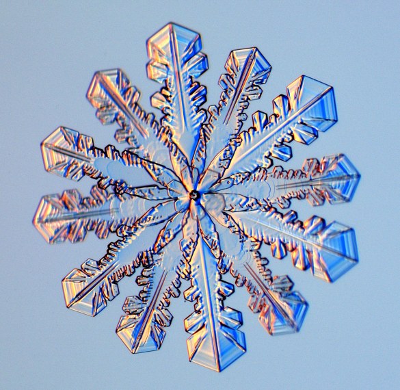
Now I will tell you about a new category called dendrites.  The first of this category to mention are stellar dendrites.  These snowflakes have branches on them like a tree and are large enough to be seen with the naked eye.  Out of all snowflakes these are the most popular to see during the winter holidays.  Some examples of stellar dendrites. 


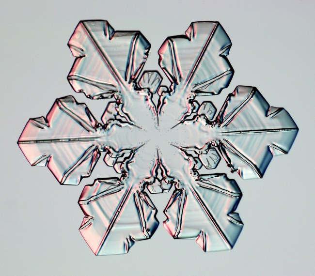
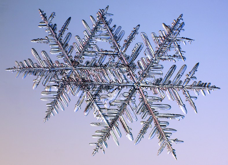
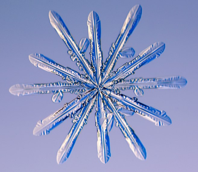
The next one is similar to the stellare dendrites but with a fern-like pattern called fernlike stellar dendrites.  Their branches look like ferns and are the largest of all the snowflakes.  Have a look. 


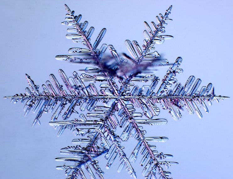
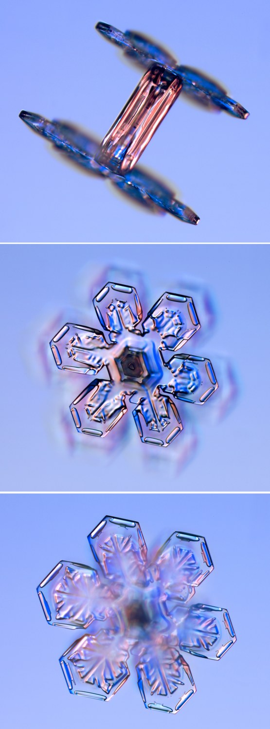
The last dendrite snowflake I will mention is similar to the fernlike stellar dendrite called radiating dendrites, also known as spatial dendrites.  What's unique about this type of dendrite is that it is truly 3-D with branches coming out from the center on the sides and the top and back.  Two images to give you an idea of what it looks like.  The first one doesn't look different from the stellar dendrite, but if you look at the blurred spot that is branches that are being looked down from a microscope.


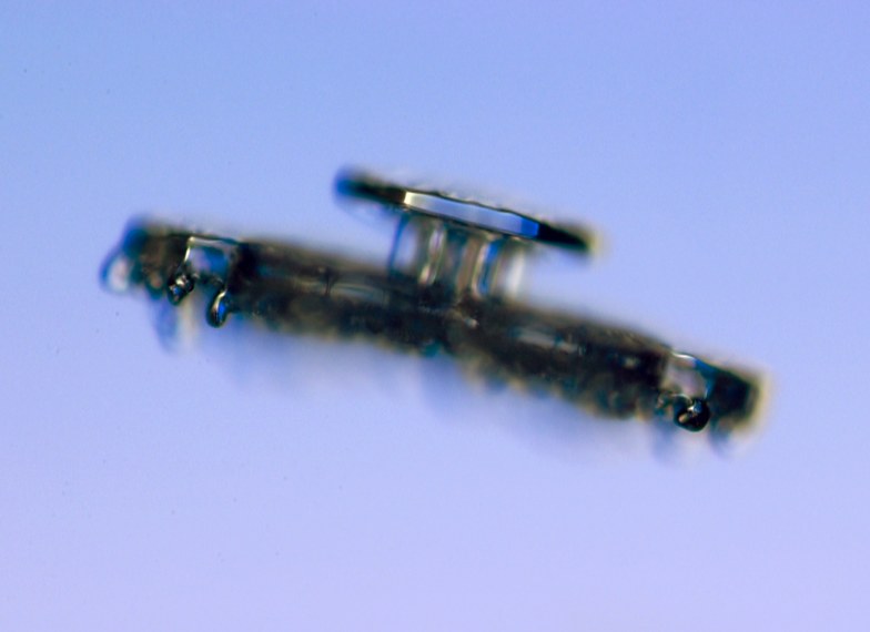
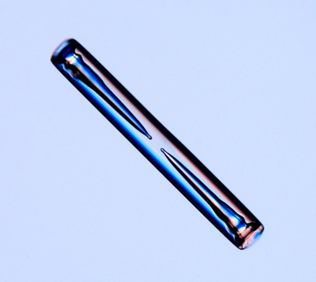
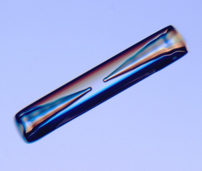
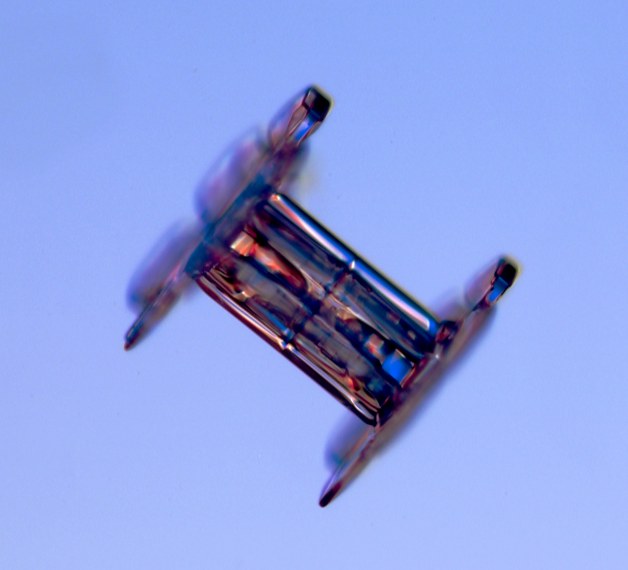
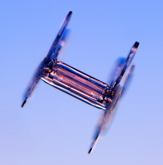
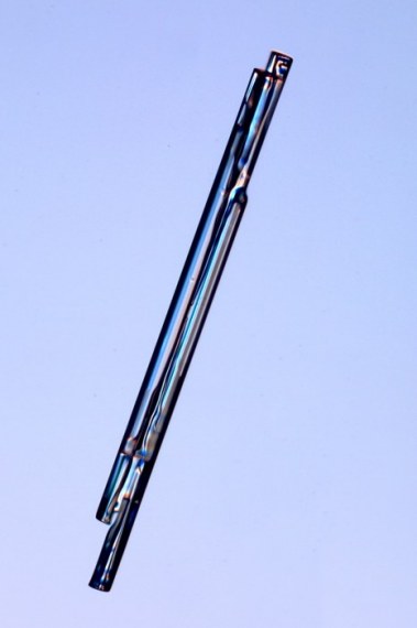
Now I will mention another category called columns which are a very unique snowflake because they dont have branches most others do.  The first of the columns are called hollow columns.  These are small columns of snowflakes that are formed from hexagonal columns that form a hollow region on both ends.  Here are a few neat images. 


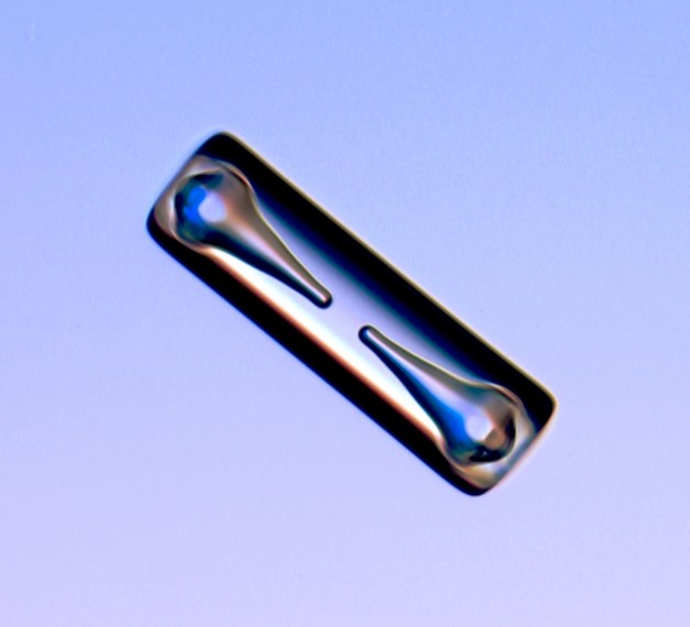
Another type of columns are called capped columns.  These are snowflakes that start out as a column, but blow up at then ends as plate-like crystals. 


The next category is very common to see and unique because it is one of the slenderest snowflakes out there.  They are called needles.  Typically are grown around 23°F and look like stubbles of white hair.  See for yourself. 


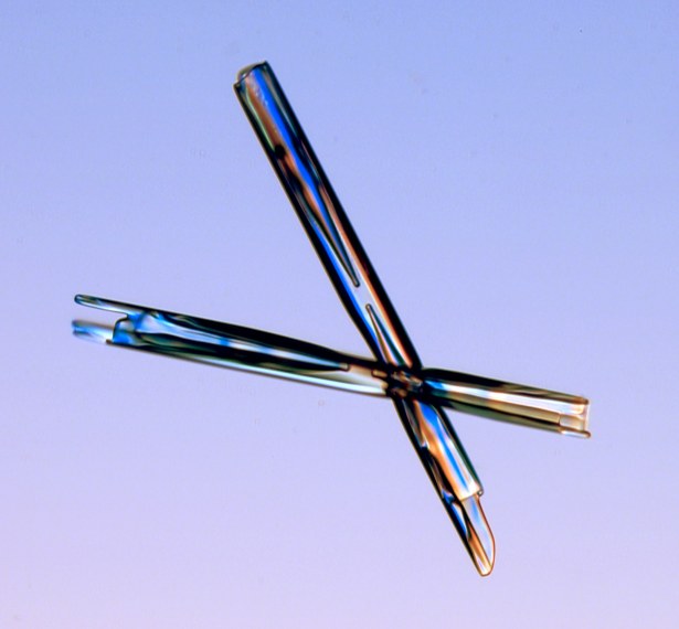
One of the most unique snowflakes is the 12-sided snowflake.  These are basically two 6-sided snowflakes that grow together with one turned 30°.  Here are a few pictures of these rare snowflakes. 


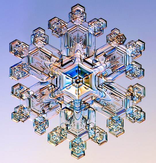
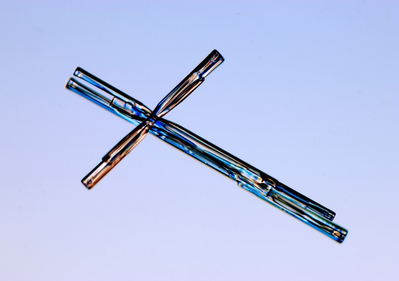
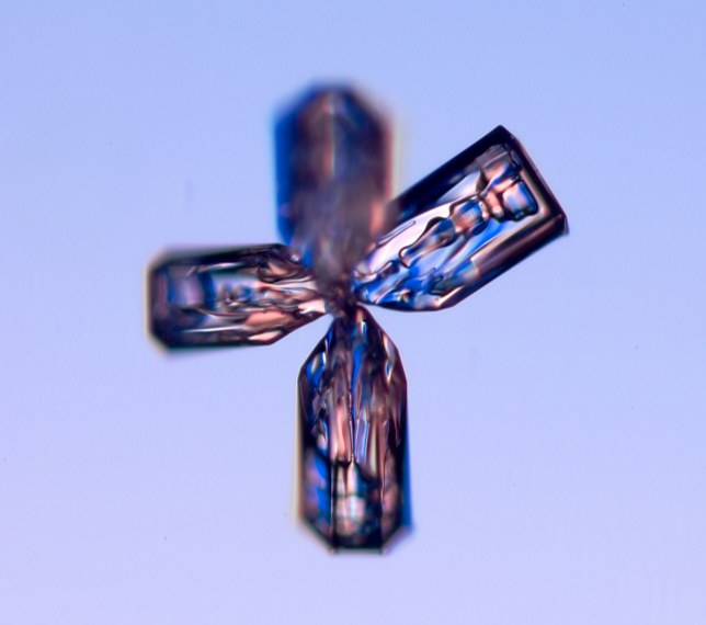
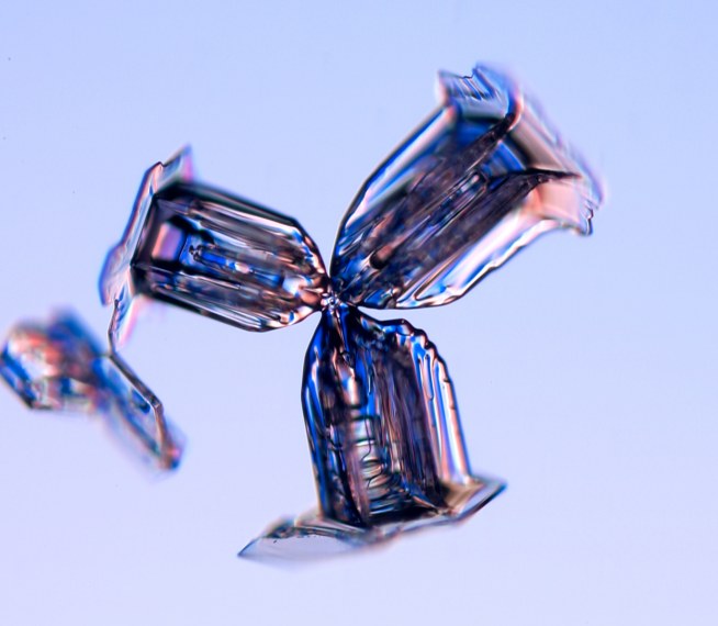
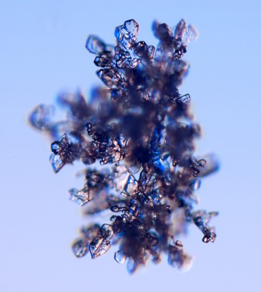
Another individual snowflake that has its own category is called bullet rosettes.  These are snowflakes that are formed from a particluar nucleus ice grain that produces column-like crystals at various orientations.  Some of these column-like crystals can be capped with a plate-like ice crystal.  To give you a better idea of what they look like I will show you a few images. 


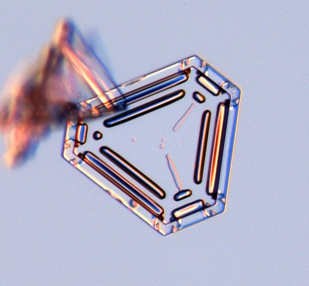
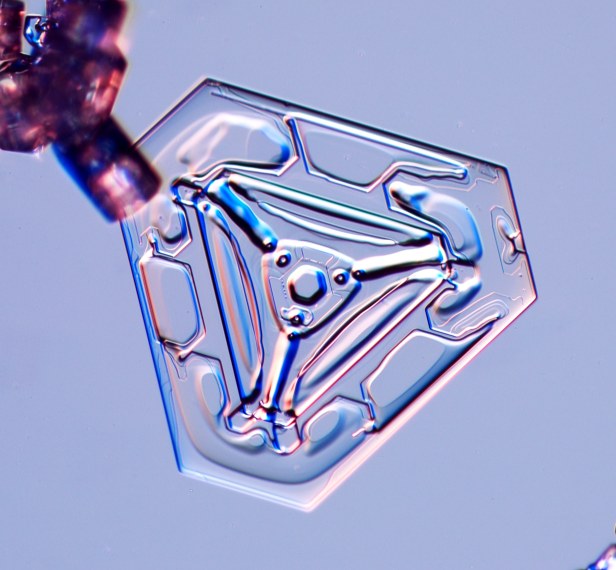
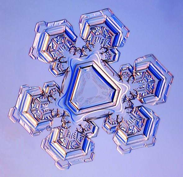
The last category I will mention about are called crystals.  Of these crystals, I will start off talking about triangular crystals.  These are, conveniently, triangular snowflakes that form around 28°F.  They are as unique as they are rare and can sometimes be seen as an odd version of a stellar plate.  Check out these triangular figures. 


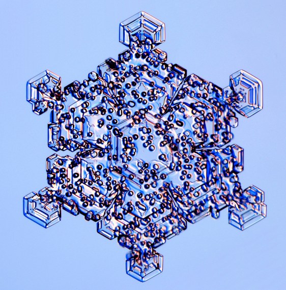
Following up are rimed crystals.  These types of snowflakes can come in different shapes such as plates or dendrites.  What makes them unique is that they have frozen water droplets on them which is where they get the name rimed crystals.  Have a look at these very common types of snowflakes. 


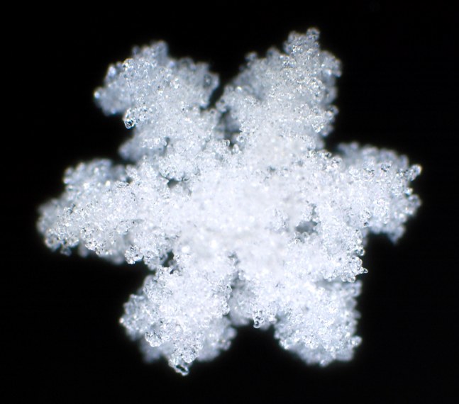
Finally, I will mention the most common and most unorganized snowflake out of all of the snowflakes and that is irregular crystals.  These are small snowflakes that are combined by random ice crystals that attacked to each other which gives it its indefinite shape.  Let's look at these oddballs. 


This concludes the different types and shapes of snowflakes.  Snow is always fun to look at, but sometimes it is even more fun just to see what kind of snow is falling.  Knowing the shapes and types will give you a better idea of how cold it is and what kind of conditions are going on in the air.  All images are from "A Guide to Snowflakes" from snowcrystals.com.  If you want more, detailed information about snowflakes go visit http://www.its.caltech.edu/~atomic/snowcrystals/class/class.htm and it will give you a much better idea of all that takes place in making these wonders of nature.